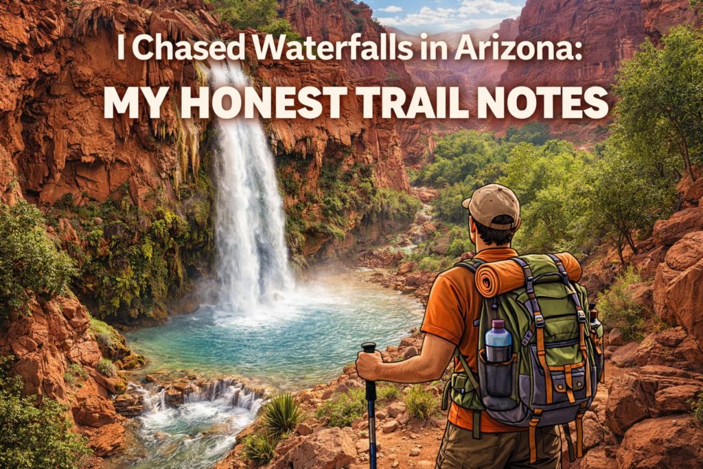
Hiking the Superstition Mountains, Arizona: My Honest Take

Quick take

I felt small out there, in a good way. Big stone walls. Sharp light. Quiet trails, then not so quiet. I’d go back tomorrow, but I’d pack smarter water and start even earlier.
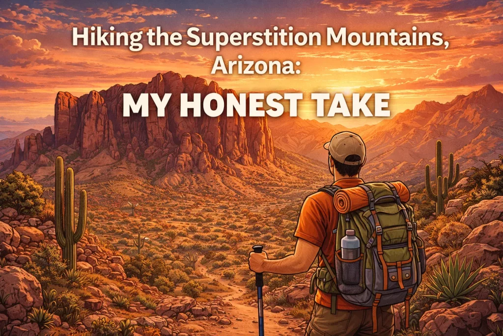
If you’d like an even deeper dive into the route, gear, and surprises, check out my extended honest take on hiking the Superstition Mountains.

Why I went (and what I hoped for)

I wanted a hard climb and big views. I also wanted the old stories—the gold myth, the weird name, all of it. If you're curious about the legends and geology, you'll find a good primer on Superstition Mountain.
You know what? I got both. The place feels old and a little spooky, but also warm and kind. Sunrise helps.

Trails I actually hiked

If you want a broader menu of nearby routes—complete with GPX downloads and current photos—check out Arizona Hiking Trails before you lace up. The Forest Service also keeps an updated list of official trail options in the area on its site for hiking in Tonto National Forest.

Flatiron via Siphon Draw (hard, but worth it)

I started from Lost Dutchman State Park before sunrise. The first mile felt easy. Then the rock chute started. It got steep and slick, so I used my hands and took my time. I slid once on smooth rock and sat down quick—no shame in a little butt-scoot.

  • Distance I tracked: about 6 miles round trip
  • Elevation gain: around 2,600 feet
  • Time: 4 hours up, 3 hours down (yes, the down was slow)

At the top, the Flatiron drops off like a stage. I ate a squished peanut butter tortilla and just stared. My knees grumbled, but my head got quiet. A small price.

Peralta Trail to Fremont Saddle (medium and friendly)

Different day, different vibe. This one rolls through tall saguaros and then climbs to a big saddle. Weaver’s Needle stands there like a movie prop. I heard a hawk. A kid near me said, “Is that the treasure?” and it made the whole crowd laugh.

  • Distance I logged: about 5 miles round trip
  • Good for: families with patient legs and folks who like steady climbs

Hieroglyphic Trail (easy, with a cool surprise)

I took my aunt here. She hates heights but loves history. We found the rock art at the end, by small pools. The carvings look like stories. We sat in the shade and ate oranges. Simple day, no stress.

  • Distance: about 3 miles round trip
  • Best in spring after rain (tiny waterfalls show up)

Best moments I still think about

  • Sunrise turning the cliffs pink, then gold
  • A roadrunner sprinting across the trail like it had gossip
  • That first view from Flatiron—clean air, deep drop, shaky legs, big smile
  • A stranger handing me a gummy bear and saying, “For courage”

Honestly, I also loved the silly parts. I tucked a little plastic gold coin in my pack for a photo with Weaver’s Needle. Did it look goofy? Yep. Did it make me happy? Also yes. Snapping that shot reminded me how much fun it is to document adventures—whether you’re capturing an epic summit or a more private indoor escapade. If you’ve ever wondered how to film those intimate moments with the same care you give a trail selfie, this straightforward guide to making a great sex tape (https://justbang.com/blog/sex-tape/) breaks down lighting, gear, and privacy tips so the memory stays just as thrilling as the moment itself.

The hard parts (but fair)

  • Heat. The rocks hold it. Start early or you’ll bake.
  • Loose gravel on Siphon Draw. My shoes slid more than I liked.
  • Crowds on weekends. Parking fills fast; the lot gets loud.
  • Cholla cactus—don’t brush it. I got one spine in my calf. Tweezers and tape saved the day.
  • Route finding near the Flatiron chute. I used an offline map and still paused twice.

I love Flatiron, but I also don’t. It hurts. But that’s why I remember it. After a day like that, my shoulders and calves beg for a serious knead; if you finish a Superstition slog with the same tight muscles, take a look at Rubmaps Coronado—the site crowdsources candid reviews of local massage spots so you can pick a place that actually melts the knots instead of your wallet.

Gear that helped me (no fluff)

  • Sturdy shoes (I wore Salomon trail shoes; grippy, but I still wanted more tread)
  • 2–3 liters of water in a CamelBak, plus a bottle with electrolytes (I used Liquid I.V.)
  • Light gloves for the scramble; my palms thanked me
  • Trekking poles for the Peralta downhill (Black Diamond aluminum)
  • A wide hat, SPF 50 sunscreen, chapstick
  • AllTrails map saved offline (service drops in the canyon)
  • Tweezers and athletic tape for cactus spines
  • A small headlamp for early starts

Food and little joys

I brought jerky, salted almonds, and those peanut butter tortillas. Oranges were gold in the heat. After, I treated myself at Dutch Bros in Apache Junction—a giant iced coffee that tasted like victory. One evening I swung by Goldfield Ghost Town for ice cream. Touristy, yes. Fun, also yes.

When to go

Fall, winter, and spring. Early morning is best. Summer? You can, but the heat feels mean, and storms can pop up fast. I’ve seen lightning stack over the ridges in July. Cool to watch, unsafe to hike.

Safety notes I wish folks knew

  • Tell someone your plan
  • Carry more water than you think you need
  • Watch your step in the chute; three points of contact helps
  • Rattlesnakes are real—give them space, no hero moves
  • If the sky builds dark towers, turn around
  • Leave the rock art alone—look, don’t touch

I met a pair who tried Flatiron with one bottle to share. We gave them extra water and sent them down. They were grateful, and a bit pale.

Who will like it

  • Folks who want a challenge and a “heck yes” summit photo
  • Families wanting a solid half-day with big views (Peralta or Hieroglyphic)
  • People who enjoy stories and strange rock shapes
  • Photographers who chase sunrise and long shadows

If you want smooth, shaded forest trails, this isn’t that. It’s sharp, bright, and open. It feels honest.

Final say

The Superstitions got under my skin. The views hit hard, and the trails ask for respect. I’ll go back for Flatiron again, even if my legs complain. I’ll bring more water, a better snack, and maybe another silly coin. Treasure or not, the place glows. And that’s enough for me.

I Chased Waterfalls in Arizona: My Honest Trail Notes

I’m Kayla, and yes, I actually hiked these. Boots on dirt. Pack on my back. Sunscreen in my eyes. You know what? Waterfalls in the desert feel like a magic trick. They’re real, though. Cold, loud, and worth the sweat.
If you want the blow-by-blow version of each splash and stumble, my expanded notes live over on this detailed waterfall guide.

Before I get into it, a quick thing. Water can rise fast here. Monsoon storms hit hard. Check weather, carry more water than you think, and respect permits. I log routes on my watch (simple GPX) and still ask a ranger when I can.

Why chase waterfalls here?

Because Arizona hides them. They’re tucked in canyons and forests. Flow changes by season. Spring snowmelt and late-summer storms make them pop. Winter can be good too. Midday light looks great on blue water. Morning is cooler. So, timing matters.
For up-to-date trail conditions and permit reminders, I double-check each route on Arizona Hiking Trails before I shoulder my pack.


Havasu Falls (Havasupai Reservation)

My trip was four days. I trained legs for a month, because the haul out is no joke.

  • The hike: About 10 miles to camp. Down first, up when you leave.
  • The water: That bright, blue-green glow. It looks fake. It’s not.
  • My moment: I stood under the spray at lunch, shoes off, hands numb. I laughed. Couldn’t help it.

Good:

  • Trails are clear.
  • Campground sits by the creek, so sleep sounds soft and steady.
  • Mooney and Beaver Falls are close, like bonus levels.

Hard:

  • You need a permit. It sells out fast.
  • Heavy pack on the climb back. My hips felt it for two days.
  • Don’t swim if storms threaten. Flash floods move like a freight train.

If you plan to make the journey, reservations open each February and can only be secured through the official Havasupai Reservations portal, so be ready when the clock strikes.

What helped me:

  • Trail runners plus water sandals.
  • A real filter, not just tablets.
  • Simple food I could eat hot and tired. Ramen, yes. Fancy stuff, no.

Fossil Creek (Camp Verde)

I’ve gone twice. Once in May, once in September. Both were warm, both were busy.

  • The hike: Short from the day-use lots. The old dam area makes a wide fall with blue pools.
  • The water: Clear, spring-fed, and chilly. Perfect after a long drive.
  • The vibe: Families, floaties, dogs, and the smell of sunscreen.

Good:

  • Easy access with a permit in season.
  • Lots of spots to sit, snack, and swim.

Hard:

  • Crowds by noon.
  • Slick rock. I saw two folks slip. I almost made it three.

The Forest Service issues the required day-use permits on Recreation.gov, and peak weekends vanish fast—lock yours in before you pack the cooler.

Pack notes:

  • Light towel and strap-on sandals.
  • Trash bag. Please pack it out.
  • I set a simple “turn-around time” like I do on work sprints. It keeps the day smooth.

Seven Falls (Bear Canyon, Tucson)

This one feels friendly. I’ve done it dry and after rain. After rain wins.

  • The hike: Long-ish but mellow. You cross the creek many times.
  • The water: In good flow, the falls stack like steps. You can sit and soak calves between climbs.
  • Tip: Start early. The sun gets loud on the way back.

Good:

  • Clear trail start at Sabino Canyon.
  • Great for visiting friends who “don’t hike much.”

Hard:

  • When it’s dry, it’s more like a chill canyon walk.
  • The tram helps, but I prefer to walk—less waiting, more breeze.

What I liked:

  • Trail snacks tasted better here. Maybe it’s the air.

Cibecue Falls (White Mountain Apache land)

This one feels wild in a tight canyon. It’s short, wet, and beautiful.

  • The hike: You cross the creek a bunch. Knee-deep in spots.
  • The water: A clean, green bowl with a tall white fall.
  • Access: You need a permit from the tribe. Respect land and rules.

Good:

  • Cool walls, cool water, cool shade.
  • Fun for people who don’t mind wet shoes.

Hard:

  • Dirt road in can be rough. My hatchback made it, but I took it slow.
  • Flash flood risk. I bailed once when clouds stacked up.

Gear I used:

  • Quick-dry shorts, wool socks, and my “beat-up” trail runners. No blisters.
  • Phone in a zip bag. Simple, cheap, works.

Water Wheel Falls (near Payson)

Short, punchy, and loud. Also, it can be dangerous.

  • The hike: A quick walk over rock and sand to big pools and cascades.
  • The water: Fast in spring. Cold year-round.
  • Memory: I walked in up to my knees and yelped. Then I stayed because it felt amazing.

Good:

  • A great half-day stop.
  • Kids were laughing, dogs splashed, everyone happy.

Hard:

  • History of flash flood tragedy here. Don’t go if storms are near. Full stop.
  • Slippery granite. I sat down more than once to scoot.

Horton Creek (Tonto National Forest)

This one flies under the radar. It’s not a single huge fall. It’s many small ones.

  • The hike: Gentle climb in tall pines. Shade helps on summer days.
  • The water: Clear steps and little chutes. Nice hum, like white noise.
  • I’d call it a “reset” trail. Slow, calm, no rush.

Good:

  • Family friendly.
  • Water most of the year.

Hard:

  • Not a “wow” waterfall. More of a long hug.
  • Get there early on weekends. Parking fills.

Tanque Verde Falls (Tucson)

Steep and rocky. The main fall drops big when it’s running.

  • The hike: Short, but it’s a boulder hop. Hands help.
  • The water: Seasonal. After storms, it roars.
  • Note: Some areas are clothing-optional. Heads-up if that’s not your thing.

Good:

  • Strong desert views.
  • The scramble is fun if you like using your hands.

Hard:

  • Polished rock is slick like ice.
  • Heat reflects off the canyon. Bring extra water. Then bring one more.

Grand Falls (near Leupp, Navajo Nation)

This one is more of a scene than a hike. But it’s a must when it flows.

  • The look: Like a giant chocolate fountain. You can hear it before you see it.
  • When: Spring snowmelt or right after heavy rain.
  • Access: Dirt roads. Respect tribal land and any posted closures.

What I did:

  • Brought a camp chair, a burrito, and just stared. Wind mist hit my face. Worth the drive.

Sycamore Falls (near Williams)

It needs recent snow or rain. When it runs, the basalt walls feel like a stage.

  • The hike: Short spur trails between viewpoints.
  • The scene: Climbers on the cliff, ravens riding the wind, water ribboning down.
  • Quiet mornings here feel like church.

How I pack for waterfall days

  • Water, then more water (Hydro Flask or soft flasks).
  • Trail runners I don’t mind getting wet.
  • Simple first aid and a small headlamp.
  • A real rain shell. Desert storms hit fast.
  • Downloaded maps on my phone plus a watch track. I’m a belt-and-suspenders person.
  • Snacks that don’t melt: tortillas, nut butter, jerky, gummies.

Quick picks (so you can choose fast)

  • Big bucket-list: Havasu Falls
  • Short and splashy: Water Wheel Falls
  • Family-friendly walk: Seven Falls or Horton Creek
  • Canyon drama with a permit: Cibecue Falls
  • Seasonal showstopper: Grand Falls or Sycamore Falls
  • Scramble lovers: Tanque Verde Falls

Traveling solo across Arizona can make logistics tricky. I’ve bartered rides, split campsite fees, and even snagged last-minute permit partners through online personal ads. A hassle-free place to browse those outdoor-friendly connections is this Craigslist-style personals board where quick, location-sorted listings help you line up a dawn carpool to Havasu or celebrate a wet Fossil Creek day with new friends over tacos.

If you’re itching for a drier, spire-filled trek after all these watery stops, take a look at my candid trip report on hiking the Superstition Mountains—it’s a perfect contrast to the splash zones above.

My quads were absolutely fried after that Superstition leg-burner, and nothing beats a deep-tissue session when the muscle knots start screaming. If you happen to swing through South Carolina on your road-trip circuit and need the same kind of relief, skim

“Hiking the White Mountains, Arizona: My trail days, straight from my boots”

I went up to the White Mountains to escape the heat. I came back smelling like pine and campfire, with dust on my socks and a silly grin. You know what? I didn’t expect it to feel this calm.

I’ve hiked Sedona and Flagstaff. The White Mountains felt different—quieter, cooler, and a little wild. Elk tracks on soft dirt. Cold creeks. Tall aspens that whisper when the wind shifts. It’s not perfect, but it’s good in a way that sticks. For a complete shift in scenery, you can read my honest take on the Superstition Mountains, where cactus and cliff faces replace spruce and aspen.

The one that stole my heart: West Baldy Trail #94

I started at Sheep’s Crossing early, when breath fog hangs low and the light is gold. If you want the mile-by-mile scoop before lacing up, the Forest Service keeps an excellent rundown on the West Baldy Trail #94 page. The trail follows a clear creek—the headwaters of the Little Colorado. I crossed logs. I slipped once and soaked a sock. I laughed and kept going.

The climb is steady. Tall spruce. A few blowdowns. At a wide meadow where West Baldy meets East Baldy, I ate a peanut butter tortilla and watched clouds build. Around 1 p.m., thunder rolled in fast. Classic summer monsoon. I put on my rain shell, told myself not to be brave, and turned back. I’d rather miss a view than chase lightning at 10,000 feet.

  • Gear that helped me here: Merrell Moab boots, Black Diamond poles, an Osprey daypack, and a Sawyer Squeeze to filter cold, perfect water. I kept the AllTrails map downloaded, since my phone had no bars. Hot cocoa from a Jetboil at the car? Best reward.

I didn’t tag the true summit. You’re not allowed up there—it’s on tribal land. It’s sacred. Staying off felt right.

Later, when the sun dipped, I heard an elk bugle down the valley. It gave me chills. I almost cried. Maybe that sounds silly. It didn’t feel silly.

A calm, shady walk: Thompson Trail #629

On another day, I took Thompson Trail along the West Fork of the Black River. It’s gentle, green, and full of quiet. Trout rose in the bends. I saw old burn scars from the Wallow Fire. Black trunks. New grass. Life trying again. It’s sad and hopeful, all at once. If the sound of running water puts you in the mood for bigger splashes, check out my trail notes from when I chased waterfalls in Arizona.

I brought my niece and nephew on this one. We tossed rocks and ate gummy bears on a log. Good shoes are still smart here. Also, bug spray. The mosquitoes near the water had opinions.

  • What I used: Sawyer Picaridin spray, a sun hat, light wool socks, and a little first-aid kit. Kept it simple.

A family stroll that still counts: Woodland Lake and Panorama

We spent a chill afternoon in Pinetop-Lakeside. The loop at Woodland Lake is easy and friendly. Dogs, strollers, grandparents. My six-year-old could handle it, and my grandma liked the benches. We ate turkey sandwiches by the water and watched coots. Later we tried a bit of the Panorama Trail for bigger views. It felt like a stretch without being a suffer-fest.

Small digression: I thought these “easy” walks wouldn’t feel like real hikes. I was wrong. They gave our legs a break and kept the joy going.

Big views, fall gold: Escudilla Trail #308

In late September, Escudilla turns to gold. Before heading out, I double-checked seasonal notes on the Forest Service’s Escudilla National Recreation Trail to be sure the route was clear of closures and snow. Aspens flash like coins in the wind. The trail climbs steady to an old lookout site, with huge views into New Mexico. It’s breezy up there. Bring a warm layer, even if the trailhead feels mild.

I did get a tiny headache from the altitude. It passed after water, a salty snack, and a slow pace. If that happens to you, don’t panic. Just go easy.

Base camp stuff that made the trip

We camped at Big Lake one night—Apache Trout Campground. Crisp air, stars like spilled sugar. I made hot cocoa and listened to owls. On another night, we stayed near Greer and ate at Molly Butler Lodge. The trout was fresh and simple. Breakfast burritos the next morning kept morale high.

Cell service was spotty. Honestly, I liked that. But it did mean I had to plan. Still, stepping away from the grid got me thinking about how I balance trail time with my online social life; if you’re curious about an adults-only platform that keeps things casual once you’re back in Wi-Fi range, check out this candid Snapsex review—it breaks down features, pricing, and safety tips so you can decide if a Snapchat-style hookup scene fits your vibe after a long weekend in the woods.

All that uphill mileage left my shoulders feeling like bricks. If post-trail soreness is your kryptonite and you’ll be road-tripping beyond Arizona, take a peek at the Rubmaps Farmington Hills guide—it compiles user reviews, pricing, and etiquette pointers so you can zero in on a legit deep-tissue fix (or something a little more indulgent) without any guesswork while passing through Michigan.

For up-to-date trail conditions and fresh route ideas across the state, I always cross-check Arizona Hiking Trails before I pack the car.

What I loved vs. what bugged me

  • What I loved:

    • Cool temps in summer. Phoenix felt like a dream far away.
    • Pine and aspen. Shade almost the whole time.
    • Creeks, elk, and quiet trails.
    • Small towns like Greer, Pinetop, and Eagar. Friendly folks, strong coffee.
  • What bugged me a bit:

    • Afternoon storms sneak in fast. Start early.
    • Mosquitoes near lakes. Not awful, but bring spray.
    • Some roads get washboarded and dusty after rain.
    • Parts of the area are tribal land. You need permits for some spots, and some places are off-limits. It’s fair—just plan.

When to go

  • Late May to June: Snow can linger, but trails open. Cool days, cold nights.
  • July to August: Lush and green. Afternoon thunder. Start at dawn, be back by lunch.
  • September to early October: Gold aspens. Crisp air. My favorite.
  • Winter: Many roads close, but you can snowshoe near Sunrise Park Resort. Bring layers. And guts.

My simple packing list that actually worked

  • 2–3 liters of water (I used a Hydrapak bladder + a backup bottle)
  • Sawyer Squeeze filter and a soft bottle
  • Light rain shell and a fleece
  • Merrell boots, wool socks, and blister tape
  • Hat, sunglasses, and zinc sunscreen (I used Supergoop)
  • Bug spray (Picaridin)
  • Poles if you like them (I do)
  • Snacks with salt: jerky, nuts, gummy bears, and a stroopwafel or two
  • Paper map, headlamp, and a tiny first-aid kit

Quick notes I wish someone told me

  • Respect the White Mountain Apache Tribe rules. Some lakes (like Hawley) need a permit, and the true Mt. Baldy summit area is off-limits. Stay on the right side of signs.
  • Roads AZ-261 and AZ-273 can close in winter and early spring. Check before you go.
  • Download maps. Cell service drops in the trees.
  • If thunder pops, drop below ridge lines and head back. No view is worth a zap.
  • Keep dogs leashed in busy spots. Pack out all trash. Leave the forest better than you found it.

Would I go back?

Yes. No doubt. I thought these mountains might feel like a smaller Flagstaff. They don’t. They feel like their own place—soft, green, a little secret. The kind of place where you drink cocoa by a sputter of blue flame, where an elk calls in the dark, and where you sleep better than you do at home.

If you’re on the fence, take it easy your first day, start early, and bring a rain shell. The White Mountains will meet you halfway. And if you hear thunder, hey—save the summit for next time. The forest will still be there, waiting.

Hiking in Southern Arizona: My Honest, Dusty, Sunburned Review

I spent two months hiking around Tucson, Ajo, Bisbee, and the little mountain towns nearby. I came home with cactus spines in my socks, a camera full of sun, and a happy heart.
Those two months became the backbone of my honest, dusty, sunburned review of southern Arizona trails, for anyone who wants the long version.

Was it perfect? Nope. But it felt real.

First, the feel of it

The desert looks tough, but it’s kind. Mornings smell like creosote after rain. Saguaros stand like old grandpas, quiet but proud. The sky goes wide, and it stays that way. You think you’re ready for the heat, and then the heat laughs.

I learned fast to start before sunrise. I also learned that “dry heat” still cooks you.

My favorite trails and the stuff that actually happened

  • Saguaro National Park West — Valley View Overlook
    I walked this one at sunset. It’s short and gentle, with a payoff that hits. The light on the arms of the saguaros felt like stage lights. I carried a tiny headlamp back; jackrabbits darted like kids late to dinner.

  • Sabino Canyon — Seven Falls
    This is the “famous” Tucson hike. When the creek runs, it’s magic. You get seven little waterfalls and smooth granite. I slipped once and sat right down in the water. Felt silly. Worth it. Note: it’s crowded on weekends, and the shuttle noise kind of breaks the mood. Bring sandals if your feet hate wet shoes.
    If you’re as waterfall-obsessed as I am, my trail notes on splashing through multiple Arizona cascades live over here.

  • Mount Wrightson — Old Baldy Trail, Madera Canyon
    Tough climb. Big gain. The air turns cool and piney near the top. I started at 5:30 a.m. and still sweated like crazy. A hawk circled over me near the saddle. At the summit, I could see clear into Mexico. My calves barked for two days. Snow can linger in winter—microspikes helped in March.

  • Chiricahua National Monument — Echo Canyon Loop
    Hoodoos everywhere. It looks like a stone city that forgot people. I heard Mexican jays, bright and bossy. I also saw a coati by the picnic area, tail up like a little flag. The loop is moderate, and shade shows up right when you need it. Bring a wind layer; it can gust out of nowhere.

  • Catalina State Park — Romero Pools
    Granite slides, cool pockets of water, and bees that loved my orange drink mix. The climb is steady; the return is hot. I dunked my hat and wore it soaking. Ten out of ten for that trick. Parking fills fast.

  • Finger Rock or Blackett’s Ridge (Tucson)
    Steep, rocky, and no nonsense. Views punch you in the face (in a nice way). I hit Finger Rock at 5 a.m. with a headlamp. Quads burned; mood soared. Watch for loose rock on the way down.

  • Organ Pipe Cactus National Monument — Bull Pasture/Estes Canyon
    Remote but gorgeous. The cacti look like a crowd at a festival. Border checkpoints are part of the day here; the rangers were kind and firm. I carried 3 liters and used almost all of it. Sunshirt saved me.

  • Superstition Mountains — Flatiron via Siphon Draw
    Brutal scramble up slickrock and scree, but the view over the Valley is chef’s-kiss. If you’re tempted, check out my honest take on wandering the Superstitions before you commit to the quad-fest.

You know what? I thought Saguaro East might be better because it’s “mountain-y.” Then I fell for Saguaro West at sunset. So I was wrong—and also right. Both sides shine. West for glow. East for big days.

For a deeper dive into route details, seasonal tips, and downloadable GPX files, check out Arizona Hiking Trails—it’s my go-to vault when I’m planning the next dusty adventure.

The good stuff I didn’t expect

  • Monsoon mornings smell like a clean garage after rain.
  • Tiny lizards sprint across the trail like wind-up toys.
  • The silence isn’t empty. It hums.

Also, Tucson has Sonoran hot dogs. After a hot hike, I went to El Güero Canelo and ate one in my car with the AC blasting. It felt like a small life win. Eegee’s frozen drinks? Perfect post-hike sugar bomb.

The hard stuff (and how I dealt)

  • Heat: It’s real. I carried 2 to 3 liters, plus electrolytes (Nuun or LMNT). If I didn’t drink, I got cranky and slow.
  • Sun: My Outdoor Research Echo Hoody and a wide-brim Sunday Afternoons hat kept me from frying. Sunscreen still mattered.
  • Cholla: Those spines hook like Velcro. I carried tweezers and a fine-tooth comb. I did pull spines from my sock on the trail. It stung, then was fine.
  • Crowds: Sabino and Romero get busy. Early start = better day.
  • Border vibes: South of Ajo and near the border, I saw Border Patrol trucks and a helicopter once. I stayed on marked trails, told someone my plan, and kept it simple. No drama.
  • Fees and passes: Saguaro and Organ Pipe have entry fees. Catalina has a day pass. The America the Beautiful pass covered most stops.

Gear that worked for me (and what didn’t)

  • Shoes: HOKA Speedgoat for long days; soft and grippy. Altra Lone Peak for wide toe days. I got a tiny blister on my right heel in the Speedgoats on Mount Wrightson, so I taped it next time.
  • Pack: Osprey Tempest 20. Light, not floppy.
  • Water: 2.5L HydraPak bladder plus a soft flask for mix. Bladder hose froze? No. But it did taste like plastic once; a baking soda rinse fixed it.
  • Poles: Black Diamond Distance Z. Great on steep descent. But they snag cholla if you’re clumsy. I learned fast to keep tips high near cactus.
  • Socks: Darn Tough micro crews. I used gaiters on sandy trails to keep the grit out.
  • Energy and recovery: On back-to-back big-mileage days (think Finger Rock at dawn followed by Romero Pools the next morning) I tried a clean-label endurance chew called Snap X—here’s the link if you want the full breakdown: Snap X — the product page details the ingredient list, user reviews, and timing tips for getting steady energy without the late-day crash.
  • Little kit: Tweezers, small comb, headlamp, salty snacks (Fritos, baby!). Paper map, because cell bars lie.

When to go

  • Best: November to March. Cool, bright, and friendly.
  • Tricky: April to June—hot, dry, windy.
  • Monsoon: July to September—stormy afternoons and stunning skies. Watch for flash floods in canyons. Trails can close after big rain.

Quick picks if you’re short on time

  • One sunset: Valley View Overlook (Saguaro West)
  • One classic: Seven Falls (Sabino)
  • One workout: Finger Rock
  • One wow: Echo Canyon (Chiricahua)
  • One big peak: Mount Wrightson

Safety and small notes I’d tell a friend

  • Drink more water than you think. If you stop sweating, that’s not a flex; that’s a problem.
  • Rattlesnakes sun on trails. I gave them room and waited. We both left fine.
  • Dogs can struggle with heat and cactus. Booties help, but some trails don’t allow dogs.
  • Pack out orange peels. The desert takes forever to break things down.
  • Check trail reports. AllTrails is helpful, but I still like the park boards and ranger notes.

Who will love it

  • Beginners: Valley View, Desert Discovery loops, and short nature trails feel kind and clear.
  • Weekend grinders: Romero Pools, Blackett’s, and long loops in Saguaro East.
  • Peak chasers: Mount Wrightson, Miller Peak near Sierra Vista. Long days; big legs.

My verdict (and one wish)

I give hiking in southern Arizona a 9 out of 10. The light, the silence, the weird beauty—it got under my skin in the best way. I’d only change two things: a bit more shade and better signs at a couple of tricky junctions near Sabino.

Would I go back? Yes. I’d bring extra water, start in the dark, and end with a Sonoran dog. Honestly, that

What I Actually Wear Hiking in Arizona (From Someone Who Sweats a Lot)

I hike all over Arizona. Phoenix, Sedona, Tucson, Flagstaff—dry heat, monsoon mess, and even snow up north. I’ve made dumb choices. I’ve also found gear that just works. Here’s what I wear now, and why, with real trails and real sweat to back it up. For an even deeper dive into my gear picks, check out what I actually wear on Arizona hikes when I’m sweating buckets.

You know what? I used to hike Camelback in cotton. I learned fast. Don’t be me. Here’s a deeper rundown on choosing sun-smart, quick-drying layers for Arizona hikes.

If you want even more Arizona trail intel than I can cram into one article, browse the routes and insider tips over at Arizona Hiking Trails.


Quick context: where I tested this stuff


Tops: sun shirts beat sunburns

My go-to hot day top is the REI Sahara Sun Hoodie (women’s). I wore it on a 98°F Camelback climb in June. It felt silly at first. A hoodie…in heat? But the fabric breathed, and the hood blocked the blaze when the sun bounced off the rock. No burn. No fried neck.

  • The good: super light, UPF, hood stays put in wind.
  • The not-so-good: it snags on prickly bushes. Mine has tiny pulls.

On milder days, I switch to a Patagonia Capilene Cool Daily shirt. Wore that on West Fork in Sedona, where shade helps. It dries fast after creek splashes.

  • The good: soft, doesn’t smell awful right away.
  • The bad: no built-in hood, so you need a hat or a Buff.

Cold morning up north? I layer a thin fleece like the Patagonia R1 (old but trusty) over a sun shirt. If there’s bite in the air, I toss a puffy in the pack. I learned that on Humphreys Peak when the wind cut through me like a sharp joke.


Bottoms: pants beat cactus (most days)

I love my prAna Halle pants (the old version) for desert hikes. I wore them on Peralta when cholla tried to hug my calves. The fabric brushed off the spines. Shorts wouldn’t have survived.

  • The good: durable, stretch, not too hot if you keep moving.
  • The not-so-good: they feel warm in June afternoons in Phoenix. I rest more.

I still wear shorts in Sedona if there’s shade or water. I like Rabbit EZ shorts for air and comfort. They feel like pajamas. But I’ll be honest: I got calf scratches from catclaw once on Cathedral Rock. Pants would have saved me.

One more trick: thin gaiters (Dirty Girl gaiters) over trail runners. On the Flatiron slog, they kept gravel out of my shoes. The prints are loud and fun. The velcro glue peeled after a year, though. I re-glued it.


Socks: wool, even in heat

Darn Tough Light Hiker Micro Crew socks are my default. I wore them on Sabino in May. No blisters, even when my feet swelled. They last forever.

  • The good: tough, comfy arch hug.
  • The not-so-good: a bit warm in triple digits.

If the day is brutal, I switch to thinner Swiftwick socks. They dry fast. But I get a tiny hot spot on my big toe with those on steep climbs. A small trade.


Shoes: trail runners for most trails, boots for sketchy scrambles

I rotate shoes. It depends on the trail.

  • HOKA Speedgoat 5: I wore these on long, rolling miles in Saguaro National Park. Cushy. My knees love them. But on Camelback’s rocky steps, that high stack felt wobbly.
  • Altra Lone Peak 8: Roomy toe box. Great on West Fork and Sedona red rock days. I feel the ground more. On sharp lava rock near Flagstaff, I wished for a tad more protection.
  • Salomon X Ultra 4 (low): My pick for steeper, rocky climbs like Piestewa. They grip well. Not as plush. A little stiff in the forefoot.

If your ankles roll easy, bring poles. I use Black Diamond Distance Z poles on steep stuff. They fold small and save my shins on the way down.


Hats, shades, and a neck thing that saves the day

I wear the Outdoor Research Sun Runner cap a lot. Yes, the drape looks dorky. But on Peralta, with the sun baking my neck, I did not care. The dark under-brim cuts glare.

  • Goodr sunglasses are my cheap, cheerful pick. They don’t slip when I sweat. Drawback: the lenses scratch easy if you toss them in your pack. I learned that fast.

For my neck, I use a Buff CoolNet UV. During monsoon heat, I’ll dunk it and wear it wet. Pure relief. It smells a little funky by mile five, but it helps.


Sunscreen that didn’t sting my eyes (much)

I’ve tried a bunch. My face hates some of them.

  • Supergoop Play felt great going on, but it ran into my eyes on Camelback. That burn is rude.
  • Sun Bum Mineral SPF 50 sticks better on sweaty days. It leaves a white cast. I’ll take ghost face over sunburn.
  • Don’t forget your hands. Sun hits there hard while you hold poles.

Packs, water, and salt

For day hikes, I use an Osprey Tempest 20. It sits snug and has a stretchy pocket for snacks. On a long Tucson loop, the back mesh rubbed when I wore a tank. With a sun hoodie, no problem.

I carry a 2–3 liter reservoir (CamelBak Crux) on hot days. Plus a soft flask or two with electrolyte mix. Nuun tabs are light and not too sweet. Liquid I.V. tastes stronger but kept me from cramping on a long, hot climb in the Superstitions.

How much water? For me:

  • Short Phoenix hike in heat: 2 liters, minimum.
  • Longer desert loop: 3 liters, plus backup bottle.
  • Sedona shade day: 1.5–2 liters is fine if it’s mild.

I also throw in a snack with salt—jerky, pretzels, or a PB bar. My mood changes fast when I forget salt. It’s not cute.


Little extras I still bring (and wear)

  • Thin liner gloves for rough rock scrambles. Saved my palms on Flatiron.
  • BodyGlide on toes and under bra strap on long climbs. Less rub, more smiles.
  • A super light wind shell (Patagonia Houdini). On Humphreys, it cut the wind chill fast. It’s not a storm jacket, but it helps.
  • Tweezers. Laugh if you want. Cholla spines happen.

After a big-mileage weekend, my quads feel like they’ve been tenderized by cactus. When I’m back east visiting family in Alabama, I hunt for a solid deep-tissue spot to loosen everything up. If you ever find yourself in the same boat, this guide to massage options in town—Rubmaps Tuscaloosa—lays out locations, hours, and unfiltered reviews so you can pick a therapist who’ll actually work the knots out of your post-hike calves.


What I wear by season

  • Phoenix summer (honestly, be careful): sun hoodie, light pants, wool socks, trail runners, hat with drape, Buff, and 3 liters of water. I start before sunrise.
  • Spring/Fall desert: sun shirt or tee, pants or shorts, light socks, trail runners, regular cap. I still pack a wind shell.
  • Sedona summer: tee or sun hoodie, shorts or light pants, gaiters if sandy, shades, lots of water. Creek stops feel amazing.
  • Flagstaff/High country: base layer, fleece, wind shell, pants, wool socks, grippy shoes or boots. The wind is real.

Things I got wrong (so you don’t)

  • I wore black tights on a July Phoenix hike. The rock heat made my legs cook. Light colors are smarter.

Four Peaks, Arizona: My Honest Hiking Story

I’m Kayla, and I’ve hiked Four Peaks more than once. I’ve gone in cool spring, hot fall, and one icy winter day that sent me home early. It’s that mountain with the four bumps you can see from Phoenix. You know what? It looks close, but it’s not. The road gets dusty and a little rough. Still worth it.

I’ll keep this real, with wins and misses. Because I had both.

Why I Finally Went

I kept putting it off. Then last April, I woke up at 4:30 a.m., tossed a granola bar in my bag, and said, “Let’s go.” I drove my dusty Subaru up Four Peaks Road and reached Brown’s Trailhead (Trail 133) around 6:15 a.m. Two trucks were there. A breeze felt nice, and the air smelled like creosote. Little things help.

Funny side note: Four Peaks is the same name on that Kilt Lifter beer. After my first summit, I bought one just because. Arizona does love a theme.

The Road In (Yep, It’s Bumpy)

The dirt road can be washboard. My car did fine when it was dry. I’ve seen low cars make it too, but I wouldn’t go after heavy rain. I once had to creep around a rut and felt my stomach drop. No shame in turning around if it looks bad.

Tip here: air up your tires first. I forgot once and felt every ripple. My coffee did a little jump dance.

The Trail: Brown’s Peak the Simple Way (Until It Isn’t)

  • Trail: Brown’s Trail #133 to the saddle, then the chute to Brown’s Peak
  • Distance: about 5 miles round trip
  • Gain: around 1,800 feet
  • Time for me: 4.5 hours with a long snack break

For an in-depth Four Peaks trail guide with current conditions, I like to skim ArizonaHikingTrails.com before I pack the car.
That same site has a detailed firsthand account—Four Peaks, Arizona: My Honest Hiking Story—that lines up perfectly with what I experienced.

If you want the straight-from-the-source details on road status, closures, and fire restrictions, the U.S. Forest Service’s Four Peaks Trail page is invaluable. Hikers also break down mileage, water notes, and maps on the Arizona Trail Association’s Four Peaks Passage page.

The first mile climbs steady through manzanita, pinyon, and juniper. In April, I saw tiny purple flowers near the rocks. A scrub jay yelled at me. At the saddle, I ate an orange and watched the light hit Roosevelt Lake. You can see the Superstitions, and sometimes the city line way off.
If those distant spires call to you, my no-fluff recap of the route is here: Hiking the Superstition Mountains.

Then comes the famous chute. It’s a Class 3 scramble. That means hands on rock. No ropes. But real care. Rocks can be loose. I kept three points of contact and moved slow. Gloves saved my knuckles. It took me about 15 minutes up, a bit more down. I’m not a hero; I scoot on my butt when it’s smart.

One winter, I tried this and hit ice in the chute. I had microspikes but no helmet. I turned around. I’m glad I did. I came back in spring and got the summit.

Season Stuff That Matters

  • Spring: wildflowers, cool mornings, clean views. My favorite.
  • Summer: heat is no joke. Start before sunrise or skip it.
  • Fall: crisp air, gold light. Watch for wind.
  • Winter: ice in the chute. Bring spikes. Check the road. It can close or get messy.

What I Loved

  • The view from the top made me quiet. Blue lake. Dark ridges. Birds riding the wind.
  • The saddle is a sweet snack spot. I could’ve sat there all day.
  • Weekday mornings felt calm. I heard my own breath. That sounds cheesy, but it’s true.

What Wasn’t Great

  • Dust. My car turned tan. I’m still finding it in the cup holders.
  • Brush near the trail can scratch your legs. I got a few lines.
  • No water. None. I packed 3 liters and used most of it.
  • Cell service was spotty. I had a bar at the saddle, then none in the chute.
  • The scramble spooked my friend. She stopped at the saddle. Good call for her.

Gear I Actually Used

  • Trail runners on dry rock; mid boots when the chute felt loose
  • Light gloves for the scramble
  • 3 liters of water, salty snacks, and a weird but good PB&J tortilla
  • Sun hat and a thin wind jacket (the summit wind cut right through me)
  • Microspikes in winter, which I used… to decide to go home
  • Want the nitty-gritty on desert-proof clothing? Check out what I actually wear hiking in Arizona; it’s my sweat-tested wardrobe.

A quick note on post-hike recovery: after pounding out 1,800 vertical feet my quads usually beg for a real massage, not just a foam-roller session in the living room. If you’re ever road-tripping through San Diego County after an Arizona adventure, consider scanning the Rubmaps Santee guide for a crowdsourced rundown of local massage spots, hours, and candid reviews that help you score a legit deep-tissue session without gambling on a random parlor.

Dogs and Kids?

Dogs can make it to the saddle, sure. I wouldn’t bring a dog up the chute. I saw a guy try to carry his dog there. It was scary, for both of them. Older kids who hike a lot might enjoy the saddle and the views. The summit scramble is for folks who like using hands and staying focused.

Little Moments I Still Think About

  • The smell after a small rain the night before. Clean and sharp.
  • A raven floating right at eye level, then tipping a wing like it knew me.
  • The orange at the saddle. Best orange of my life, no contest.

Quick Tips Before You Go

  • Start early. Parking is small, and shade is rare.
  • Bring more water than you think you need.
  • Helmet is smart in the chute; rockfall can happen.
  • If there’s ice, don’t push it. The mountain will be there next week.
  • Check your gas. The drive out feels long when you’re on E.
  • Tell someone your plan. Service is hit-and-miss.

My Bottom Line

Four Peaks is a real Arizona classic. The hike to the saddle is lovely and steady. The push to Brown’s Peak is short but serious. On a clear spring day, it felt perfect for me. Honest truth? I’d do it again on a weekday after rain, when the air is clean and the road is dry. I’d bring gloves, extra water, and one very patient friend.

If you don’t already have a go-to adventure buddy for trips like this, consider browsing a community-focused platform such as PlanCul; the app makes it easy to meet nearby outdoorsy people, chat about interests, and line up a safe, mutually agreeable trial hike before committing to bigger objectives.

Nude Hiking in Arizona: My Real Take

I’m Kayla. I hike a lot. I review gear for a living. And yes, I tried nude hiking in Arizona. Not as a stunt. Not for shock. I wanted to know how it feels, what works, and what doesn’t. You know what? It’s both simple and tricky.

Let me explain.

Why I Even Tried This

Arizona heat is no joke. Shirts get sweaty, fast. Shorts ride up. I kept thinking, what if I just… skipped the clothes? Less rubbing. More breeze. A little weird. A little brave. So I set clear rules: private places first, remote public spots only at quiet times, and a cover-up within reach.

Where I Actually Went (Real Spots)

  • Shangri La Ranch (New River): It’s a nudist resort north of Phoenix. If you want to see exactly what creature comforts wait back at base after a dusty loop, their amenities list spells it out. I did the little 2-ish mile loop by the wash at sunrise. Saguaros, quail, soft sand, no stares. Totally relaxed. Staff was kind. No pressure. Great first try. Also, no cactus balls rolling at you. That matters.

  • Remote BLM desert near Table Mesa Road (north of Phoenix): Weekday dawn, winter. I parked off a side spur, took a faint jeep track, and hiked out-and-back. I kept a black pair of Patagonia Baggies in my pack’s side pocket. A dusty truck came by around mile two. I slipped the shorts on in five seconds. No drama. I did have a cholla ball jump at me later. Tweezers came out. That stung. But I was fine.

  • El Dorado Hot Springs (Tonopah): Private soaking. I asked about walking the back path around the tubs. They said fine. Short and slow. Super mineral smell, warm air, date palms rustling. One bee kept liking my hat. I kept sandals on. Wet ground plus bare feet is a bad mix.

None of this felt spicy. It felt like normal hiking, just… lighter. Funny, right?

The Gear I Trusted (and What Flopped)

This part is my jam. I used real stuff I use on normal hikes, with a few tweaks.

  • Shoes: Merrell Moab 3 Low + Darn Tough socks. Grippy and boring in a good way. I tried my Chaco Z/Cloud one day near Wickenburg. Goathead thorns got me. Sandals felt cute. My toes did not agree. Closed shoes win in cactus country.

  • Pack: Osprey Daylite with a 3L CamelBak bladder. I like the bite valve on the right strap. The pack rubbed my bare shoulders, so I slid a soft bandana under the straps. No hot spots after that.

  • Sunscreen: Blue Lizard Mineral SPF 50 on shoulders, chest, back, butt, and tops of feet. I also kept Supergoop Play spray for quick re-coats. Zinc is thick, but it lasts. I missed a stripe behind my knee once. That stripe glowed red for two days.

  • Hat: Sunday Afternoons Ultra Adventure. Wide brim. Chin strap. Wind came up near Cave Creek one morning, and that strap saved me.

  • Cover-up: Patagonia Baggies 5-inch and a light linen sarong. Both pull on fast. I also carried a Matador quick-dry towel for sitting on rocks. Hot rock plus bare skin is a bad combo. Trust me.

  • Chafe and skin stuff: Body Glide on inner thighs and where pack straps touch. I don’t skip this now. Also a tiny first aid kit with tweezers. Those jumping cholla clusters act like they’re alive.

  • Extras: Sawyer Picaridin spray near water (gnats), a whistle on my sternum strap, and LMNT packets for electrolytes. The citrus one tastes salty, but it kept my legs from cramping.

Curious what I reach for on days when I do keep my clothes on? Check out the sweat-tested outfit breakdown in my full “What I Actually Wear Hiking in Arizona” guide.

What It Actually Felt Like

Not naughty. Not wild. Just free. The breeze on my back felt like air-conditioning. I noticed smells more. Creosote after a light rain is the best desert smell. Gambel’s quail popped through the brush like tiny linebackers. My pack hummed against my spine. Sounds odd, but it helped me remember my posture.

There were downsides. The sun hits places you never think about. Tops of feet. Back of arms. The little dip by your collarbone. Miss a spot and you’ll pay. Also, grit sticks to sunscreen. I took a damp bandana to wipe off dust before re-applying.

The Etiquette That Kept It Chill

  • Time and place: Early morning on weekdays. Far from trailheads and popular spots. No Sedona hot zones. No family trails.
  • Cover fast: Keep shorts, a sarong, or a big tee in reach. If I saw people, I stepped off trail, turned away, covered up, and waited. Easy.
  • Private land first: Resorts or places with clear rules are the easiest start.
  • Be kind: If kids or groups appear, I’m dressed before they get near.
  • Leave no trace: Pack out trash. Sit on a towel. Don’t crush cryptobiotic soil. Stay on durable surfaces.

Quick note on laws: Arizona has indecent exposure rules (A.R.S. §13-1402). I’m not a lawyer. I keep it private, respectful, and away from others. Private property with permission is safest.

The Safety Stuff I Won’t Skip

  • Water: In cool months I carry 2–3 liters. Warm days need more.
  • Weather: Winter mornings can bite. Monsoon storms pop up in summer afternoons.
  • Wildlife: Rattlesnakes like warm roads and rocks. Give them space.
  • Plants: Cholla and prickly pear love ankles. Kneel with care.
  • Signal: Tell someone where you’re going. My iPhone SOS gives me peace.

Seasons and Spots That Fit

  • Best months: October through April. I like December and February most. Bright sun, cool air, quiet trails.
  • Crowds: Sedona is packed. Superstition Wilderness is busy on weekends. Remote BLM roads north of Phoenix or out by Aguila feel calmer.
  • Resorts: Shangri La Ranch in New River was my easiest “yes.” I’ve heard Mira Vista in Tucson has trails too, but I haven’t walked those yet.

If you’re plotting a trip farther south, don’t miss my dusty, sunburned field notes on the region in this honest Southern Arizona hiking review.

For even more ideas on classic (and fully clothed) routes you can scout before committing to a nude option, check out the trail library at ArizonaHikingTrails.com.

Who This Is For (And Who It’s Not)

If you crave quiet and hate clingy clothes, you’ll get it. If you worry about people seeing you, start on private land. Bring a friend who understands the vibe.
Not everyone has a built-in hiking partner, of course. If you’re hunting for adventure-minded friends or a potential romance who won’t flinch at a zero-clothes dress code, check out this thorough Bumble review to see how the app’s filters, safety tools, and vibe can help you screen for fellow outdoorsy types before you lace up your boots.

Post-hike soreness is real, and sometimes the best reward after a cactus-dodging, quad-burning Arizona loop is a professional rub-down. If your travels ever land you near Chicago’s northern suburbs and you want to pre-vet massage spots that cater to adults seeking serious muscle relief, the candid rundown at Rubmaps Vernon Hills lays out reviews, prices, and what to expect so you can choose a therapist with confidence.

This isn’t for Instagram. It’s for you and the sky and the wind.

My Surprises, Good and Bad

Good:

  • No sweaty waistband.
  • Skin cools fast with even a tiny breeze.
  • I felt more present. My steps got lighter.

Bad:

  • Sun is ruthless. Miss one spot and you’ll remember.
  • Pack straps can pinch bare skin without a barrier.
  • Sandals plus cactus? Nope.
  • A truck can show up out of nowhere. Have that cover-up ready.

Would I Do It Again?

Yep. I already have. My favorite memory is a cold blue morning north of Phoenix. I watched the sun rim a saguaro. Breath fogged once, then stopped as the day warmed. Quiet, like the land held its breath right back. I slipped on my shorts when I heard an engine, waved, and then went back to walking. Simple.

Final Take

Nude

My Arizona Hiking Trip: Dust, Sun, and A Lot of Water

I went to Arizona with one big plan: hike till my legs complained, then hike a little more. I packed my Osprey daypack, broke in my Altra Lone Peaks, and told myself, “Slow is smooth.” That was cute. Arizona had other ideas. For the full play-by-play, I pulled those first impressions together in My Arizona Hiking Trip: Dust, Sun, and A Lot of Water.

I went in April. Warm days, cool mornings, yellow brittlebush in bloom, and that dry wind that sneaks up on you. It felt like someone turned a hair dryer on low and forgot to turn it off.

Why Arizona?

Red rock. Big sky. Real trails that make you earn the view. Also, I wanted tacos after every hike. That part worked out.

I started in Phoenix, slid over to Sedona, then up to the Grand Canyon. A simple loop. Simple-ish.


Day 1: Camelback Kicked My Shins (and My Ego)

I hit Camelback’s Echo Canyon at 5:15 a.m. The lot was almost full, no joke. Headlamps flickered up the ridge. The first part felt easy. Then the rails started. I put on light gloves. The rock was steep, polished, and a little slick with fine dust.
For trail nerds who want every data point—rail locations, mileage markers, and safety notes—here’s a comprehensive guide to hiking Camelback Mountain’s Echo Canyon Trail that covers it all.

I passed three people who were already panting and thought, “I’m fine.” I wasn’t. The last push is a scramble that uses hands and knees. My heart thumped like a drum. I carried 2 liters of water and finished most of it. Poles? I left them in the car. You need both hands.

Time up and down with a snack break: about 1 hour 50 minutes. The sunrise washed the city in pink. I stood there, sweaty and happy, and ate a peanut butter tortilla that stuck to my teeth. That’s when I felt the first tiny rock in my shoe. Welcome to Arizona.

Tiny tip: parking fills fast. Be nice to the rangers. Also, sunscreen sticks better than lotion when you’re sweaty. I used Blue Lizard and a goofy hat. No shame.


Day 2: The Superstitions Taught Me Respect

Flatiron via Siphon Draw. This one humbled me. If you like a deep dive before you lace up, bookmark this in-depth overview of the Flatiron via Siphon Draw Trail—it lays out the chokepoints, elevation profile, and must-pack gear.

The trail starts strong, then turns into a rock chute. The rock looks smooth—almost like poured concrete—but it’s real and steep. Near the top is “the Wall.” It’s a short, hand-over-hand move. Not hard, but you feel it.

I carried 3 liters, plus a packet of electrolyte tabs. Halfway up, my calves started to twitch. I forgot salt the day before, so this time I mixed a bottle with lemon electrolyte powder. Tasted like a melted lemon drop. Worked like a charm.

I followed the cairns (those tiny rock piles) and took breaks where the wind slid through the notch. My hands got dusty and a little scraped. I didn’t mind. The view from Flatiron looks like the whole valley got rolled out like a map. Plan on 5 to 6 hours. Mine took 5.5 with photo breaks and a very slow down-climb.

Did I get a cholla spine in my leg? Yes. Did I pull it out with a plastic comb I keep in my first aid kit? Also yes. Learn from me: carry a comb and tweezers.

On the way out, I bought prickly pear lemonade at a stand near Lost Dutchman State Park. Sweet, cold, and a tiny bit sticky. Worth it. If you’re scheming your own assault on those crags, don’t miss my honest take on hiking the Superstition Mountains.


Day 3: Sedona’s Red Dust Stained My Socks (I Loved It)

I set my alarm for rude-o’clock and aimed for Devil’s Bridge. I parked at Dry Creek Road around 5:45 a.m. The 4×4 road to the closer lot is rough, so I walked it. The air smelled like sage and red clay. My shoes turned the color of paprika.

The climb to the bridge is short and punchy, with stone steps and a little scramble near the top. It’s wider than it looks in photos, but I still felt my stomach flip when I stepped out. A couple from Houston clapped when I made it across. We passed a phone around like a hot potato and took photos for each other.

After that, I drove to Cathedral Rock. The trail is steep sandstone with tiny ledges you grab with your fingers. If your shoes have sticky rubber, you’ll grin. If not, your heart will talk to you. I saw a guy try it in flat sneakers. He slid. He turned around. Good call.

I ended the day with red dust up to my ankles, and a bag of Haribo in my car. The gummy bears melted into one giant bear. I ate it anyway. No regrets. Sedona whet my appetite for nearby peaks—my saga on Four Peaks lays out how rugged those summits get.


Day 4: Grand Canyon — Down Feels Easy… Then You Look Up

I did a safe sampler: South Kaibab to Ooh Aah Point at sunrise, then later walked part of Bright Angel to the 1.5 Mile Resthouse. I didn’t go to the river. Don’t try that in a day unless you really know your body and the heat. People get in trouble fast here.

South Kaibab has no water, but the views are ridiculous. The ridge-line feels like a roller coaster with cliffs on both sides. I watched a mule train pass—bells, dust, and that slow, steady pace. On the way back up, I counted steps and breathed slow. Hike a bit, pause a bit. Simple rhythm.

Bright Angel has water spigots (check season), shade, and a kinder grade. I used poles for the climb. My knees said thank you. Total time, both parts, with long gawking breaks: around 4.5 hours. The wind on the rim cut through my sweaty shirt. Funny thing—I thought the sun would be the worst. It wasn’t. The wind stole my heat. I pulled on a light puffy and ate an RXBAR while watching a raven do lazy loops over the cliffs.

If you’re heading south instead of north, my gritty, sun-scorched recap of hiking in Southern Arizona covers what the desert down there throws at you.


Tiny Fails That Taught Me Stuff

I forgot to reapply sunscreen on Camelback. My nose peeled. That fiasco is partly why I toyed with ditching the clothes altogether—my very candid thoughts on nude hiking in Arizona live elsewhere for the brave. I also tried new socks on Flatiron—dumb move. Hot spots showed up fast. A little strip of tape saved me, but still.

Another fail: I packed poles for Devil’s Bridge. They got in the way on the scramble. I stashed them behind a juniper and grabbed them later. Don’t worry—I remembered where.

Also, I almost skipped breakfast before South Kaibab. I ate a banana and half a bar in the lot instead. Huge mood shift. Food is pace.

Long hours alone under that desert sky can also spark a craving for company once the boots come off. If that rings true after your own mileage, take a peek at Uber Horny—the site makes it ridiculously easy to meet like-minded adults nearby so you can trade more than trail beta when the sun sets.

On the more practical side of post-trail recovery, my calves were so knotted after Flatiron that I would have paid gold for a legit deep-tissue session. If you ever limp back toward the Pacific Northwest and pass through the Tri-Cities, browse Rubmaps Richland—the crowd-sourced listings break down which parlors, therapists, and price points actually deliver relief, so you can swap trail pain for a proper rubdown without any guesswork.


If You’re Planning

If you want a single source that breaks down trail distances, water points, and current conditions, browse the detailed guides on ArizonaHikingTrails.com before you lace up.

  • Start early. Shade is your friend.
  • Tell someone your route. Reception drops a lot.
  • Don’t count on water unless the park says

Red Mountain, Arizona: My Honest Hike (With Dust In My Shoes)

I hiked Red Mountain near Flagstaff on a cool Saturday morning. I wanted shade. I wanted weird rocks. I got both—and a lot of red dust in my socks. Worth it. For the nitty-gritty stats, I later typed up a longer field report for Arizona Hiking Trails—read that Red Mountain deep-dive here.

Quick vibe check

It’s short. It’s pretty. It’s easy, but not boring. The hoodoos look like melted castles. Kids stare. Grown-ups stare too. You think, how is this even real?

Getting there (without fuss)

I drove up Highway 180 from Flagstaff toward the Grand Canyon. There’s a small dirt lot and a clear sign for Red Mountain Trail. No water. No trash cans. No bathrooms. The air smelled like pine and a little like warm dirt—sweet, almost like vanilla. If you know Ponderosa pines, you know.
If you want even more trip-planning intel, I like the concise overview on Arizona Hiking Trails. For official mileage, parking, and seasonal notes, the Forest Service Red Mountain Trail No. 159 page is another solid resource.

I tossed on my Osprey Daylite pack, laced my Altra Lone Peak trail shoes, and filled my 32 oz Hydro Flask. I also brought a light windbreaker. It gets breezy up there.

The trail, step by step

The path is soft cinder. It crunches and slides a bit, like walking on tiny marbles. It’s mostly flat, maybe a small slope here and there. My watch showed about 3 miles round trip. Easy on the lungs, but remember, it’s high elevation, so take it slow if you’re from lower, hot places (hi, Phoenix). If you do call the Valley home and crave something tougher the next weekend, the Superstition Mountains will happily oblige.

About halfway in, the trail squeezes into a narrow gap. There’s a fence with a wooden ladder-style step. My sister handed me her phone while she climbed. Our dog waited and then hopped up with a little boost. It’s fine, but small kids may need a hand.

Past the fence, the canyon opens like a theater—big red walls, tall spires, strange shapes cut by wind and rain. Hoodoos everywhere. The dirt glows in the morning light. (If you want to geek out on the volcanic forces that sculpted these shapes, the USGS has a detailed explainer that’s well worth a read.) We stood quiet for a minute and just listened. No cars. Just wind and a soft grind of grit under boots.

I touched the rock—warm and grainy, like baked sand. Photos come out great. Honestly, every angle looks good.

Real talk: the good and the not-so-good

  • What I loved: The weird rock forms. The easy trail. The cool air compared to the valley. The shade from pines at the start.
  • What bugged me: Cinder dust sneaks into socks. The ladder gets backed up when it’s busy. People wander off trail and climb high—please don’t. The rock is fragile.

On a crystal-clear day you might even spot the hazy outline of Four Peaks far to the south—a fun reminder of how much diverse hiking terrain northern Arizona hides.

My gear that worked (and what I wish I had)

  • Shoes: Altra Lone Peak trail runners. Grippy on cinder, comfy.
  • Pack: Osprey Daylite. Light, simple.
  • Water: Hydro Flask 32 oz. I drank most of it. Bring more in summer.
  • Extras: Buff for dust, sunglasses, small first aid, and a thin jacket.
  • Wish I had: Gaiters to keep cinders out. On a winter day, I’d add microspikes. It can get icy here.

I tracked the route on AllTrails offline and also pinned a note in Gaia GPS, just in case my phone lost signal. It didn’t, but habits stick.

Timing and seasons (yes, it matters)

Morning is best. The red walls pop in soft light. By noon, it feels harsher and the lot fills. In July and August, storms hit fast in the afternoon. I’ve seen folks get soaked in minutes. In winter, the trail may be snowy or packed ice. Spring and fall are lovely. When midsummer temps still feel suffocating, I’ll often head east to the high-country forests of the White Mountains for a multi-day fix—but Red Mountain is perfect when I only have a morning.

After, I grabbed a hot chocolate at Late for the Train in Flagstaff. Warm hands, happy legs. A tiny tradition. If your adventures ever have you limping around southern Minnesota with tight calves instead of dusty socks, a quick stop at the RubMaps Mankato directory can point you to crowd-reviewed massage spots, complete with service details and locations, so you can score some much-needed muscle relief without the guesswork.

Speaking of post-hike downtime, I recently fell down an online rabbit hole exploring how AI-powered sexting bots can keep conversations lively when you’re stuck in a tent during a rain delay or just killing time on a long road trip. This practical guide to sexting bots breaks down the top services, privacy considerations, and etiquette tips so you can experiment safely and find the right digital companion if that’s your thing.

Safety and manners (the un-fun stuff that matters)

  • Leash your dog. There’s wildlife and it’s a tight space.
  • Stay on trail. The rock breaks easy.
  • Pack out trash. All of it.
  • Watch the sky. If thunder talks, you leave.
  • No bathrooms. Plan ahead.

Who will love this hike?

  • Families who want a short, wow-filled walk.
  • Photographers who chase texture and color.
  • Geology nerds (I say that with love).
  • Anyone who needs a peaceful hour with tall rocks and quiet air.

My quick verdict

I’d hike Red Mountain again, but on a weekday. It’s a small trail with a big payoff, and it’s kind to tired legs. If you want a scenic break that doesn’t wipe you out, this is it. Dusty socks and all. You know what? That’s part of the charm.

—Kayla Sox

Payson, Arizona Hiking Trails — My Honest Take After Dusty Miles

I’ve done a lot of hikes around Arizona. Payson keeps pulling me back. The pines. The creeks. The big Rim views that make you go quiet for a minute. You know what? It feels like a quick reset that still makes your legs work. Earlier this season I logged big desert miles in the craggy Superstition Mountains, but the cool pines up here are a whole different flavor.

I drive up from Phoenix, toss my pack in the trunk, and hit the road. It’s not far. The air cools. The trees get taller. My shoulders drop. That’s the vibe.

First Impressions (and a little truth)

Payson trails give shade and water, which is rare here. But they also bring crowds on weekends. Parking fills fast. The rocks get slick by the water. My feet learned that the hard way. Still, I keep going, because the creek sounds and the pine smell just stick with me.

Let me explain with the hikes I actually did.
If you want an even deeper menu of Rim Country treks, the trail rundowns on Arizona Hiking Trails break down mileage, water access, and difficulty in one quick scan. For the story behind my own dust-caked loop through many of these same routes, check out my extended field notes on Payson, Arizona hiking trails.

Horton Creek Trail — the one I think about mid-week

I started at the Horton Creek Trailhead near Kohl’s Ranch. It’s an out-and-back along a roaring creek. (For the official scoop, conditions, and any seasonal alerts, the Tonto National Forest maintains an official Horton Creek Trail page that’s worth a quick look before you drive up.) I hit the dirt at 7 a.m., crisp air, light jacket. The trail is soft with needles and roots. My Salomon trail shoes gripped fine. I heard water the whole time, like a low song.

About four miles in, the spring pours straight from the hillside. Cold and clear. I sat on a flat rock, dipped my feet, and ate half a peanut butter sandwich. A trout flashed in a pool. I forgot to check the time. That felt good.

  • What I loved: steady shade, water every few minutes, easy rhythm
  • What bugged me: more people after 9 a.m.; a few muddy spots made me slide

Water Wheel Falls — fun, but watch your footing

This one starts at the Water Wheel Day Use Area. I grabbed a Tonto Pass on the way, because rangers do check there. The hike is short, but it’s a hop-and-scramble along the East Verde River. I wore Chacos and, honestly, should’ve kept on real trail shoes. Algae on the rocks is like butter. I watched a guy go down hard. He was okay, but yeah—go slow. Anyone who likes the idea of roving from pool to pool might dig my statewide scouting report on other splash-worthy routes, where I literally chased waterfalls all over Arizona.

The pools are deep and cold. I dunked quick. Brain freeze level cold. The roar of the falls washes out chatter, which I liked, since it can get busy.

  • What I loved: swimming holes, big granite, rush of water
  • What bugged me: weekend crowds, loud music, and some trash near the falls

Highline Trail (Pine Trailhead to Geronimo) — tougher, worth it

I took a chunk of the Highline, starting in Pine. It’s rocky, with short punchy climbs and wide views of the Mogollon Rim. (If you want a broader rundown of routes skirting that escarpment, the Town of Payson posts a concise Mogollon Rim trail guide that helps map distances, trailheads, and seasonal notes.) I used Black Diamond poles, and I was glad. My Garmin buzzed every mile, and I ignored it by mile three because the views kept stealing my brain. Way off on the southern skyline I could make out the shark-fin ridge of Four Peaks, a range I wrote about after a windy summit push—details live in my Four Peaks hiking story.

I saw elk prints in dusty patches and a horned lizard sunning on a warm rock. Wind carried the smell of sap and dust. I’m not saying it felt easy. It didn’t. But the mood? Calm.

  • What I loved: less traffic, big quiet views, honest workout
  • What bugged me: loose rock and a couple of eroded edges that made me pause

See Canyon to See Spring — short, cool, calm

I did this in October. The leaves by the creek turned gold, and the air had a bite. It’s a gentle climb up a green corridor with a sweet payoff at the spring. The water bubbles up like a secret. I filled my Sawyer filter and sipped. Cold enough to make my teeth sing.

  • What I loved: fall color, soft trail, easy water refill
  • What bugged me: trail gets narrow in parts; passing with dogs was a shuffle

A fast one along the Rim — breezy and bold

On another trip, I parked near Rim Lakes Vista off Forest Road 300 and strolled the edge. It’s more like a walk than a hike, but the drop is huge and the wind can slap your hat clean off. Storm clouds stacked way out on the horizon. I could see forever, or close enough.

Gear I actually used

  • AllTrails offline maps on my phone (signal drops a lot)
  • Salomon trail shoes for grip; Chacos only for short water stuff
  • Hydro Flask 32 oz plus a soft bottle
  • Black Diamond poles for the rockier miles
  • Sawyer Mini water filter at springs and creeks
  • Sunscreen, a cheap bug net in spring, and a small towel

Post-hike, when the packs are dumped and the shoulders are screaming, I sometimes daydream about a solid massage to unkink everything. Travelers who find themselves limping through the Mid-Atlantic after an Arizona trip can scope the in-depth Rubmaps Germantown guide for a lineup of local parlors, user reviews, and tips on snagging the kind of deep-tissue session that resets tight trail muscles for the next adventure.

Tiny note: I packed socks. I thought. Found one. Hiked anyway. My heel did not thank me.

Little headaches I ran into

  • Fees: Some sites need a Tonto Pass. Keep it visible.
  • Crowds: Weekends pack out. Cars line the road by 10 a.m.
  • Slippery rocks: Any green or dark rock by the creek is a no-joke slip zone.
  • Monsoon season: Flash floods happen fast. If clouds build, I head out.
  • Winter ice: The Rim trail edges can ice over. I’ve used microspikes a few times.
  • Dogs: I love them, but please leash near water and passes. Less chaos, fewer scares.

Food after the hike (because yes)

I’ve hit Macky’s Grill in town for a burger and sweet tea. The fries taste extra good after creek miles. For coffee, I’ve grabbed a latte at Common Grounds. In Pine, Old County Inn has wood-fired pizza that disappear fast if you set it near me.

If you cap a long day on the trail and wish you had adventure-minded company for that burger or an upcoming trek, browsing the outdoor-friendly listings on JustBang’s adult personals classifieds can match you with locals who share your love of fresh air and spontaneous road trips. Filter by interests, swap trail stories, and line up a meetup so your next Payson outing doesn’t have to be a solo mission.

Who will like Payson trails?

  • Families who want shade and a creek
  • Trail runners who like rolling terrain
  • Photographers chasing Rim light and fall leaves
  • Dog folks who keep it tidy and leashed where needed
  • Anyone who needs quiet, but not a suffer-fest

Quick tips from my pack brain

  • Start early. Cooler, calmer, kinder.
  • Check fire rules and weather. I do a fast scan before I go.
  • Bring more water than you think you need.
  • Pack a towel and sandals for creek days.
  • Leave no trace. If you can carry it in, you can carry it out.
  • Tell someone your plan. My phone has gone dead up there.

My final take

Payson feels like a deep breath you can take on a short drive. Horton Creek owns my heart on weekday mornings. Highline wakes my legs up. Water Wheel is fun when I pick a quiet hour and watch my step.

Will I go back? Already planning it. I want the pine shade, the cold water, and that moment near the Rim where the world goes still. Honestly, that’s why I hike here.